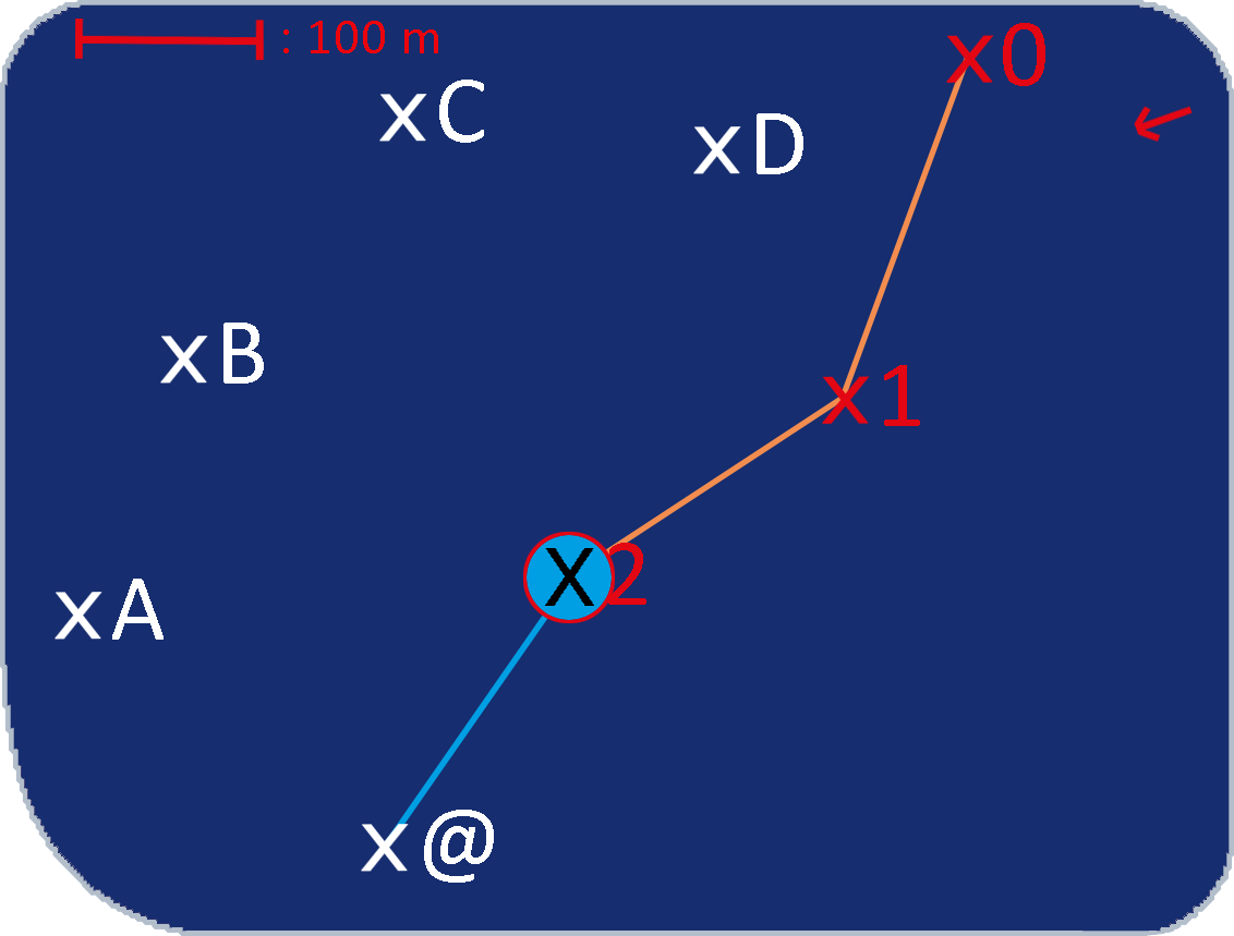
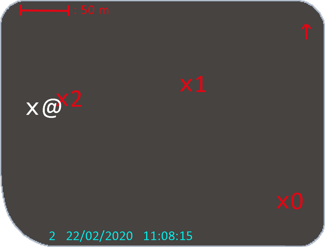
To locate oneself
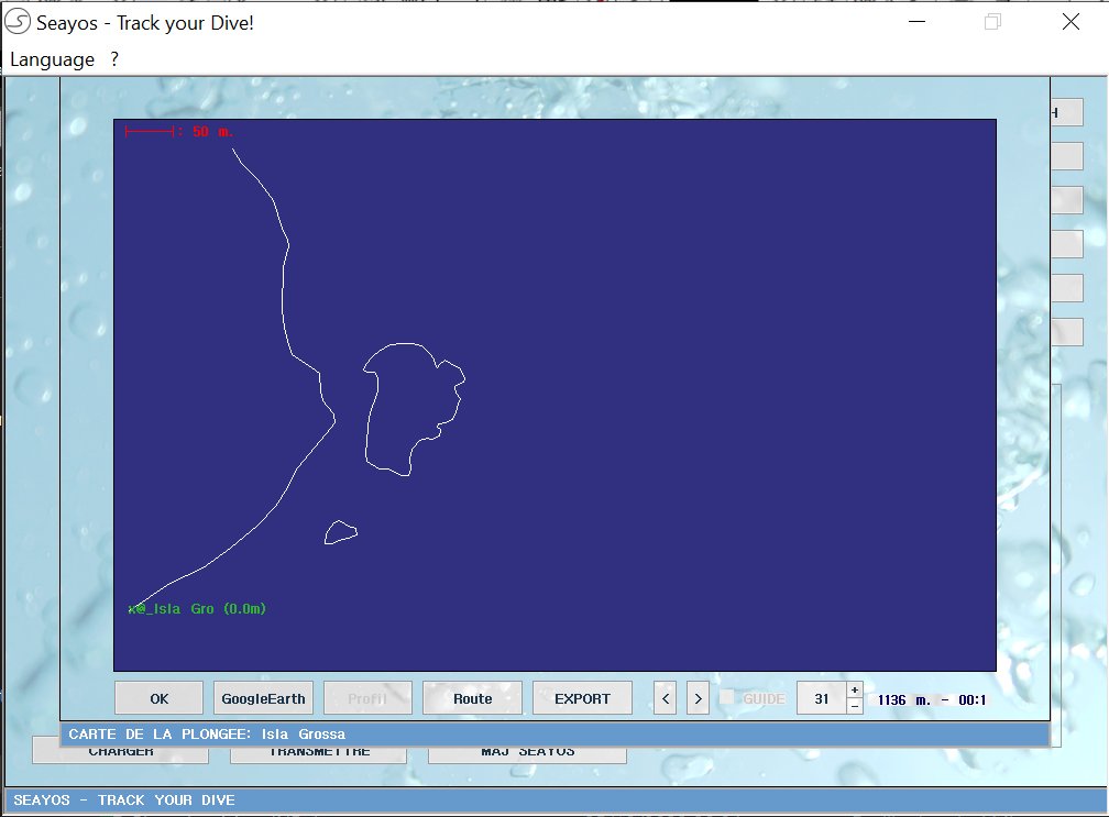
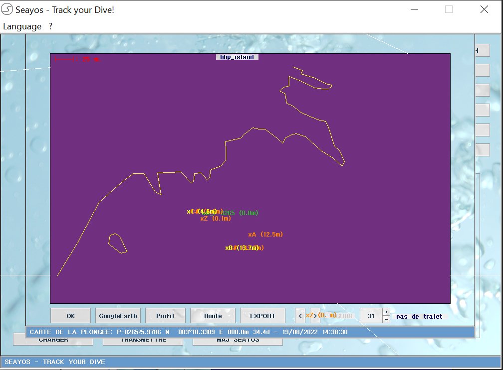
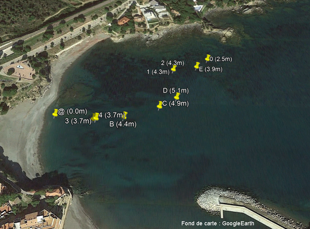
The display of schematic maps in the SEAYOS makes it easy to locate oneself in relation to other points, whether they have been surveyed during the dive or imported via the PC interface. These maps can be displayed at any time, including during guiding, and can be found in the SEAYOS dive log.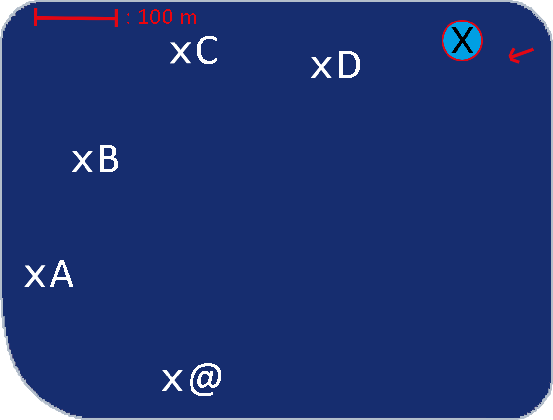
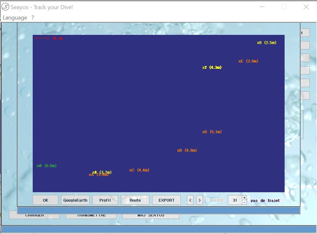
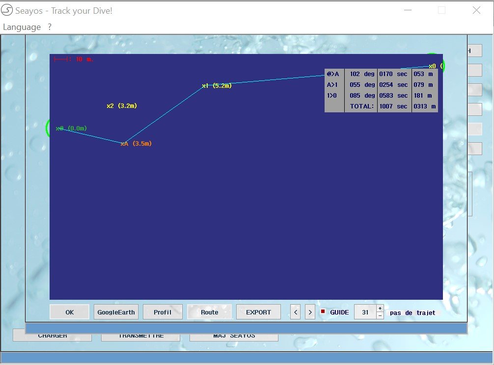
The SEAYOS PC interface also allows to display dives in map form.
Digital and cartographic processing
In addition to all the intrinsic functions offered by the SEAYOS PC interface, it also acts as a bridge, enabling files to be imported and exported to and from numerous mapping tools (such as Géoportail and GoogleEarth) and GIS software (such as QGIS).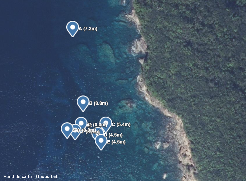
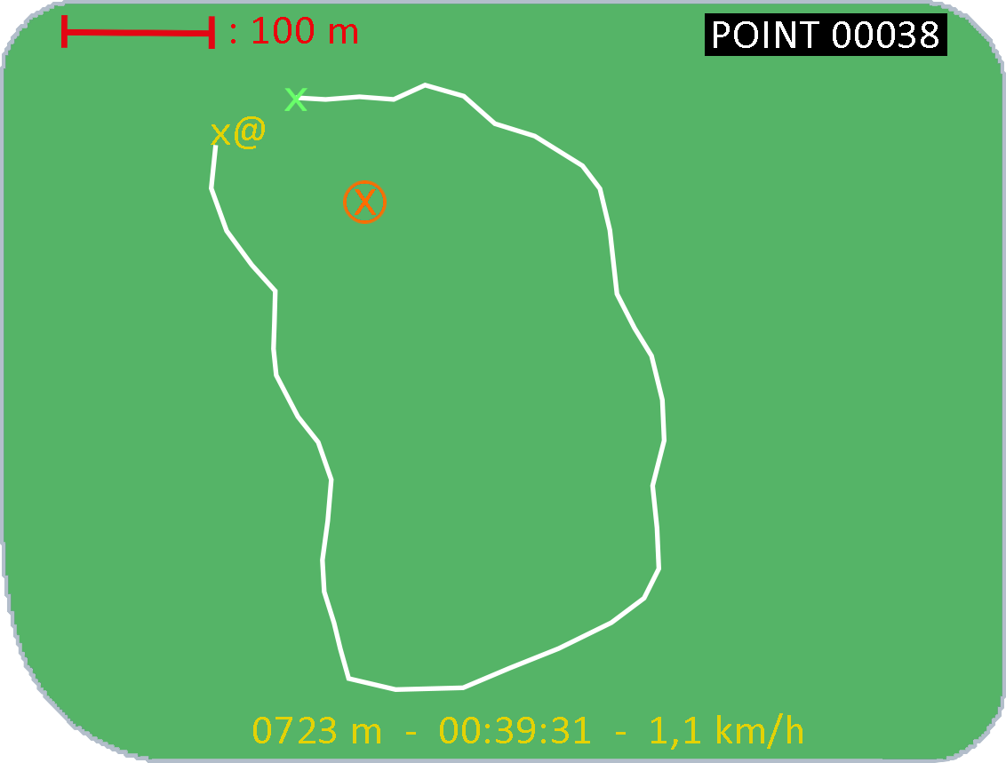
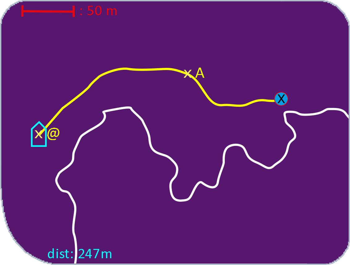
Record continuous routes
As well as acquiring specific points, the SEAYOS can also record continuous routes at the surface : it is the «tracking» function. In tracking mode, the SEAYOS remains ont the surface for as long as you wish to record the route. Thus, the diver tows the SEAYOS (unlike the recording of points for which the SEAYOS only remains on the surface for a few seconds), like the buoys towed during drift dives.The SEAYOS Tek HD and Pro are supplied with a raft (270g buoyancy) which is an accessory dedicated to the "tracking" function. It aims to significantly increase the SEAYOS buoyancy and to guarantee better continuous recording of routes, in particular when the sea is rough or the dive is carried out in fresh water. However, it is possible to use the SEAYOS in "tracking" mode without this accessory. A 2nd raft, with greater buoyancy, is available as an option.

Map backgrounds
The SEAYOS can be used to manage map backgrounds, which are a specific type of favourites. They are made up of polygons or straight lines, which can be used to define search zones, for example. They can be created directly in the SEAYOS using a "tracking" made during a previous dive or be imported from the PC interface. The SEAYOS can manage up to 9 different map backgrounds. Map backgrounds can be displayed during a guiding or a tracking, which allows to located oneself in relation to predefined zones, the coast, contour lines, etc.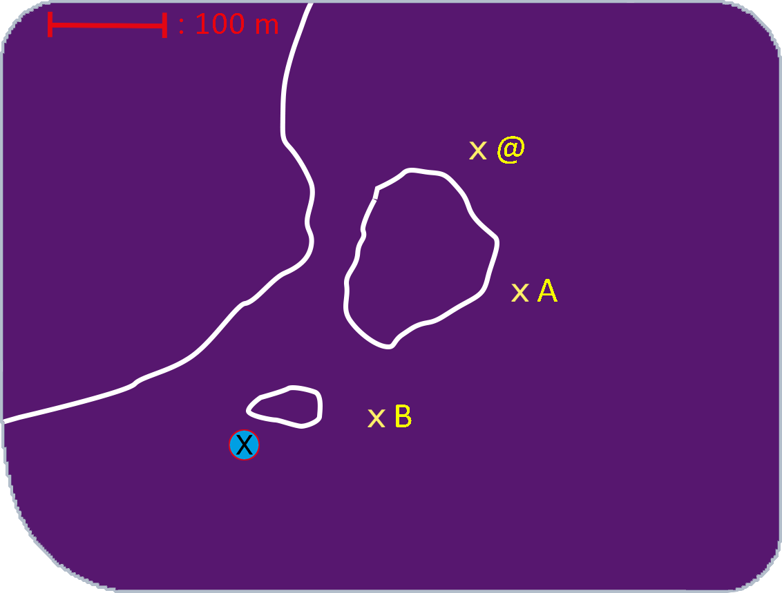
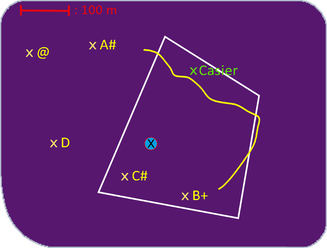
Map backgrounds can also be displayed in the SEAYOS dive log. Similarly, a dive can be displayed on a map background in the SEAYOS PC interface.